pktools  2.6.7
Processing Kernel for geospatial data
Public Member Functions | Public Attributes | Static Public Attributes | List of all members
qgis.pkfilter_spatial.pkfilter_spatial Class Reference
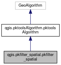
Inheritance diagram for qgis.pkfilter_spatial.pkfilter_spatial:
Inheritance graph
[legend]
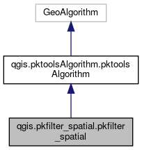
Collaboration diagram for qgis.pkfilter_spatial.pkfilter_spatial:
Collaboration graph
[legend]

Public Member Functions

def cliName (self)
 
def defineCharacteristics (self)
 
def processAlgorithm (self, progress)
 
- Public Member Functions inherited from qgis.pktoolsAlgorithm.pktoolsAlgorithm
def getIcon (self)
 
def checkBeforeOpeningParametersDialog (self)
 
def help (self)
 

Public Attributes

 name
 
 group
 

Static Public Attributes

string INPUT = "INPUT"
 
string OUTPUT = "OUTPUT"
 
list METHOD_OPTIONS = ["none", "median", "var", "min", "max", "sum", "mean", "dilate", "erode", "close", "open", "homog ", "heterog ", "sobelx ", "sobely ", "sobelxy ", "sobelyx" , "smooth", "countid", "smoothnodata values", "threshold local filtering", "ismin", "ismax", "order", "mode", "stdev", "mrf", "dwt", "dwti", "dwt_cut", "scramble", "shift", "savgolay", "percentile"]
 
string METHOD = "METHOD"
 
string DIM = "DIM"
 
string NODATA = "NODATA"
 
list PADDING_OPTIONS = ["symmetric", "replicate", "circular", "zero"]
 
string PADDING = "PADDING"
 
string RTYPE = 'RTYPE'
 
list TYPE = ['none', 'Byte','Int16','UInt16','UInt32','Int32','Float32','Float64','CInt16','CInt32','CFloat32','CFloat64']
 
string EXTRA = 'EXTRA'
 

Detailed Description

Definition at line 38 of file pkfilter_spatial.py.


The documentation for this class was generated from the following file: